WHAT IS WILDFIRE RISK MONITOR FOR INSURANCE?
Kayrros Wildfire Monitor’s new-generation risk modeling tools measure risk exposure more accurately and can help measurably reduce insurer loss ratios.
Map-based forecasting, active fire monitoring and near-realtime damage assessments enable more accurate insurance underwriting, improved asset risk management and more connected crisis awareness.
Kayrros is taking physical risk assessment to the next level.
///
WHY IS OUR WILDFIRE RISK MONITOR UNIQUE?

Fact-based
modeling
Kayrros uses measurements of physical parameters and not simulated events or historical data. Our model captures the latest changes in vegetation, urban expansion and +15 other ground-truth measurements.

360-degree
risk views
Kayrros delivers insights at each stage of a wildfire, from pre-fire risk assessment to active fire monitoring and post-fire damage assessment.
///
OUR WILDFIRE RISK MONITOR FEATURES
Reliable risk analytics
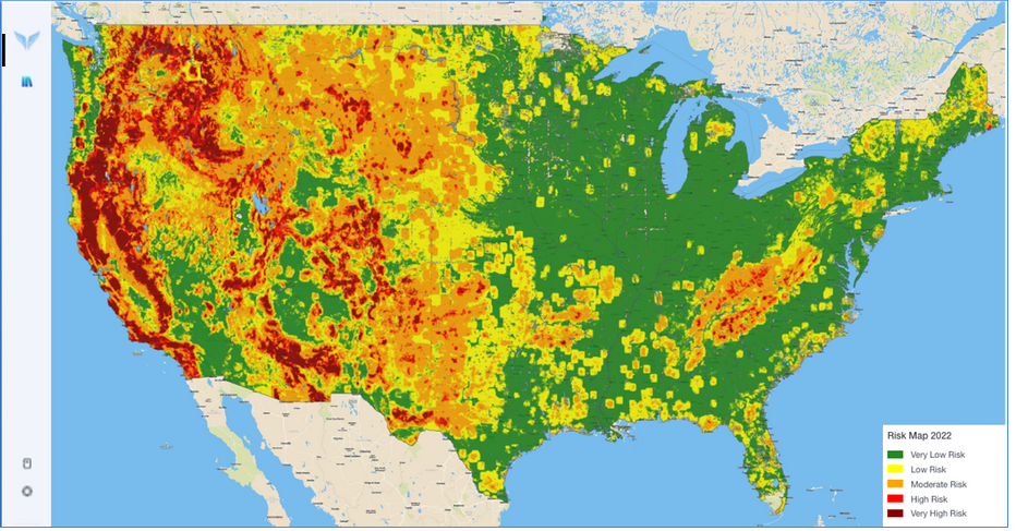
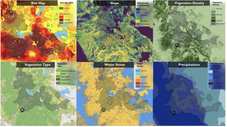
Get access to risk scores, breakdown of risk factors, and evolution of risk for complete transparency. Kayrros provides powerful maps to understand risk exposure with asset upload and look-up features.
Dynamic view of risk at each stage
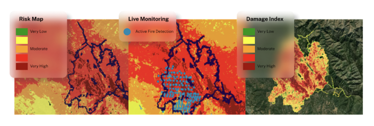
Get the latest risk exposure data with a monthly refresh, live monitoring and alerting of active fires. Get access to damage assessment maps just days after fire containment.
///
WHAT DO YOU GET?

Fire prediction
Get risk maps with 50-m resolution and risk analytics of your area of interest through a personalized dashboard, APIs, and Excel files.

Fire monitoring
Get access to interactive maps with active fire detection points and fire footprints–updated multiple times per day via APIs and the Kayrros platform. Get email alerts when a new active fire is detected or when assets or areas of interest are at risk of being impacted by active wildfires.
Fire damage assessment
Get the final fire footprint and damage assessment maps with 10-m resolution– available within days after final fire containment. Intermediate damage assessment maps can also be provided for longer fire events. Available through APIs and the Kayrros platform.
///
OUR OTHER PRODUCTS
Vegetation Clearing

Maximize your operational efficiency by knowing the vegetation index around buildings and infrastructures exposed to fire risk
Forest Carbon Monitor

Evaluate the performance of climate action project with insightful data on nature-based solutions
Crude Oil
Intelligence
Optimize trading decisions with comprehensive, granular near-realtime crude oil inventory measurements
///
RECENT POSTS
The Global Methane Pledge, Three Years On: Partial Progress Report
Kayrros Carbon Watch introduces EU carbon emissions forecasts

